


Industry Overview
Aquionix provides high quality, efficient and responsive environmental, health and safety products, services, programs and support. We help our clients effectively manage compliance while promoting workplace safety, occupational health and corporate sustainability.


General Industry
Through 25 plus years of customer referrals, Aquionix has realized an incredible expansion in the number and scope of services sectors in which it continues to deliver superior quality EH&S consulting services…

Mining
Aquionix has a detailed understanding of EH&S regulations applicable to the mining sector anchored in years of research, practical experience, agency collaboration, interpretive application in everyday mining operations and successful client advocacy…

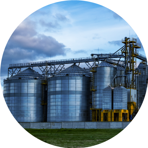
Oil & Gas
Aquionix has a detailed understanding of ever changing and complex EH&S regulations applicable to the oil and gas sector anchored in years of research, practical experience, agency collaboration, interpretive application in everyday oil and gas operations and successful client advocacy...

Food and Beverage
Not unlike industrial and manufacturing clients, the brewing and food industries also have a myriad of complex environmental, health and safety (EH&S) regulations that apply to their operations. Aquionix brings 25 plus years of experience to the table when assisting our clients with complex compliance problems...

Our Services

Development and integration of environmental, health, and safety management systems to enhance operational efficiency and regulatory compliance.
Management systems
Services focused on air permitting, compliance audits, and pollution prevention to ensure regulatory compliance and environmental protection.
Air quality
Solutions for hazardous and non-hazardous waste management, including waste minimization, recycling strategies, and management program development and implementation.
Waste management
Sustainability
Implementation, certification and maintenance of sustainability programs.
Reclamation &
land management
Custom health and safety programs designed to reduce workplace incidents and comply with regulations.
Field services
Performing and managing EHS field services and sampling projects for wastewater, groundwater, surface water, stormwater, waste, and soil.
Water quality
Water permitting and management strategies to protect water resources and meet corporate goals or permit requirements.
Spill prevention
SPCC plans and training to prevent and respond to environmental incidents.
Custom health and safety programs designed to reduce workplace incidents and comply with regulations. Site assessment, remediation, reclamation and land management activities.
Health & safety programs

Our Projects
At Aquionix, we pride ourselves on delivering innovative and effective solutions that meet the diverse needs of our clients. Our projects span various industries and showcase our commitment to excellence, sustainability, and customer satisfaction. Here are some of our notable projects.


Case Study
Corporate EHS Management System
Case Study
EHS Management System

Case Study
Air Quality Data Management

Case Study
Oil and Gas Compliance

Case Study
ISO Audits

Case Study
Mining SPCC Plan

Why Aquionix?
Aquionix offers high-quality, efficient, and responsive environmental, health, and safety products and services. We help clients manage compliance, enhance workplace safety, promote occupational health, and support corporate sustainability.
Our offerings include management systems, air and water quality management, waste management, health and safety programs, spill prevention, sustainability, reclamation, and field services. Aquionix serves various industries,
including general industry, mining, oil & gas, and food & beverage.

Working As One Team
Join our dynamic team at Aquionix, where creative, sustainable, and innovate solutions drive our problem solving process in order to meet our clients complex needs. Be a part of a collaborative environment that values your contributions and supports your professional growth.

Innovative Environment
Join our dynamic team at Aquionix, where innovation and sustainability drive the solutions we provide to address our clients problems…
Collaborative Culture
We believe in the power of collaboration. You'll be part of a supportive and inclusive team that looks for values your contributions…
Professional Growth
Your professional development is our priority. Aquionix offers a wealth of opportunities for learning, professional development, and advancement…
Newsletter


“I just wanted to... let you know how pleased I have been working with [the] Aquionix team... Early this year, our compliance projects were an area I was uncomfortable with our status, and I feel confident we are both back on track and have a well organized plan for the rest of the year. [Aquionix] has been very knowledgeable on all the topics we are working through, and very prompt and professional with... recommendations and work.”
Contact Us
Please come by our office, call us, or submit the form below to contact us.
